Bournemouth Airport (BOH)
City Orientation and Maps
(Bournemouth, England)
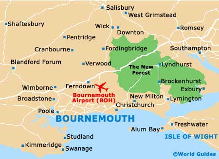
The town of Bournemouth is amongst the most popular seaside resorts on the south-western coast of England and is located in the county of Dorset. A spreading town full of tourist appeal, Bournemouth stretches between Christchurch to the east, and Poole, which lies to the west and is famous for its harbour area.
Other areas of interest close to Bournemouth include the town of Boscombe, which is situated just 5 km / 3 miles to the east and offers a wealth of shopping opportunities. Further afield you will find Salisbury 45 km / 28 miles to the north of Bournemouth, Wimborne just 16 km / 10 miles to the north-west, Fordingbridge around 27 km / 17 miles to the north, and Southampton, which is approximately 53 km / 33 miles to the north-east.
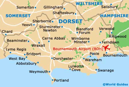
Also within easy driving distance of Bournemouth are the cities of Portsmouth, which is around 83 km / 52 miles to the far east, and London, the capital of England and just 168 km / 105 miles to the north-east of Bournemouth. Many people flying into Bournemouth Airport also choose to visit the New Forest National Park, which is within easy driving distance and can be reached along the A31, to the north-east.
Bournemouth International Airport (BOH) Maps: Important City Districts
Bournemouth pier clearly marks the very centre of the main seafront area, with both the town centre and the busy train station lying to the north-east. The town's tourist information office is located alongside the Winter Gardens, on Westover Road, and provides a range of the usual leaflets and maps expected.
England Map

Dorset Map
Bournemouth Map